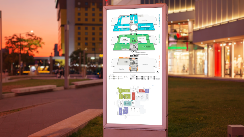
What is a wayfinding system?
A wayfinding system is a tool or suite of tools that works to help people navigate their physical environments and orient themselves in their location in space. A suite of wayfinding tools can include directions, symbols, colors, kiosks, maps and other communication tools that help viewers effectively find their desired locations. Today, these tools also integrate with wireless technologies, including mobile applications, digital displays and RFID.
How Does A Wayfinding System Work?
There are many ways to integrate wayfinding systems into your day-to-day operations, like via a geographical map, a physical kiosk or a more cognitive map. When creating your wayfinding scheme, there are a few characteristics that you should keep in mind:
- Navigation: Navigation is the physical “direction” to your destination of choice. Things like signs and roads can serve as navigation in a wayfinding system.
- Orientation: To navigate, you must be able to tell where you are in the wayfinding system (and when you’re going in the correct direction). This will make it easier to find your destination, locate landmarks and more. Such effective navigation is obtained using a tool like a map.
- Landmarks: Landmarks are particular locations that make a wayfinding system more legible and easier to use. Landmarks can include objects, buildings, art installations, museums, etc.